
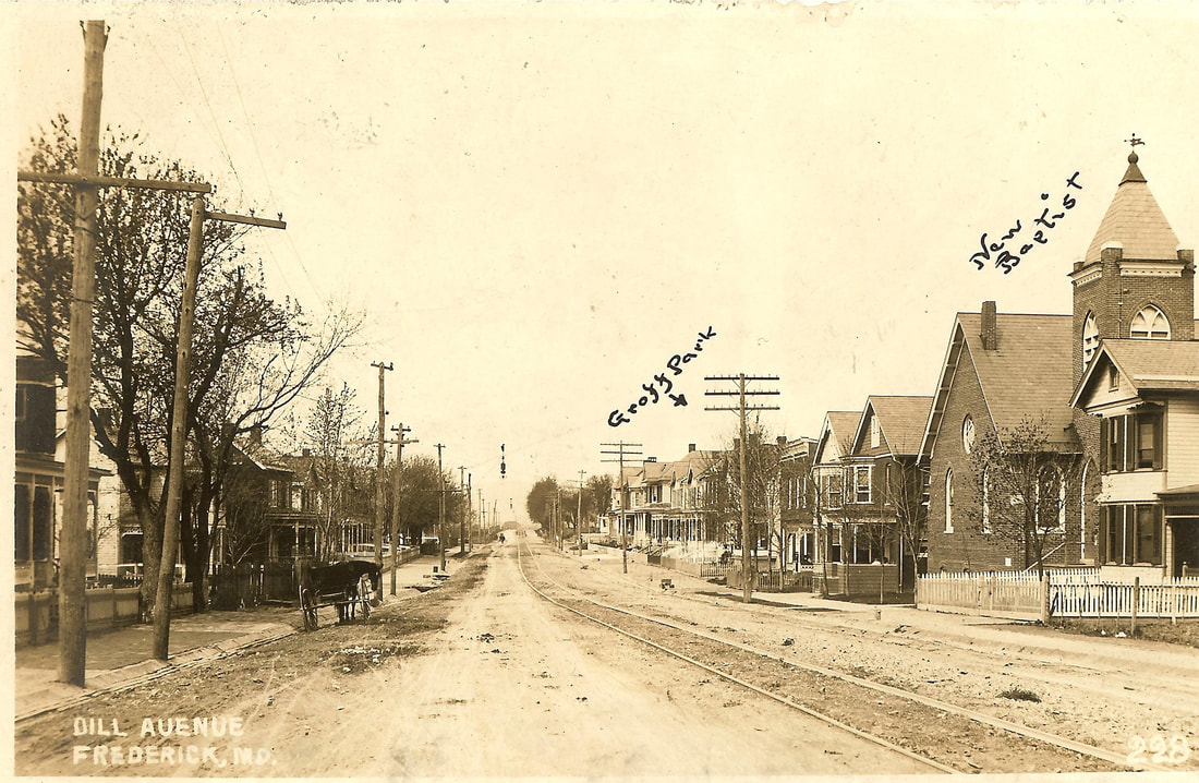
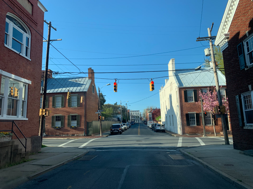
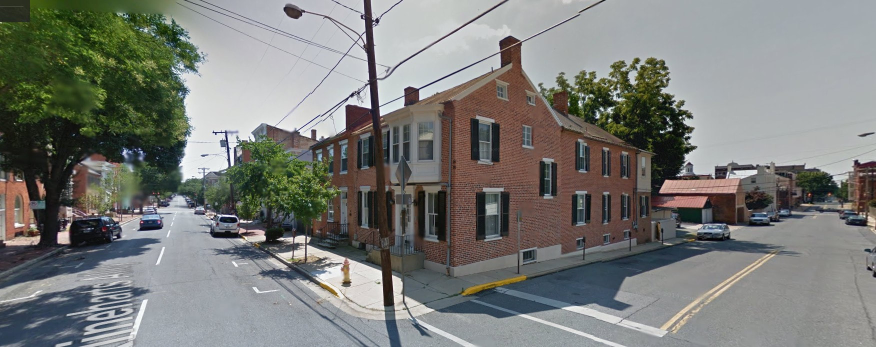
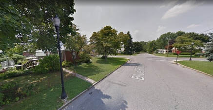
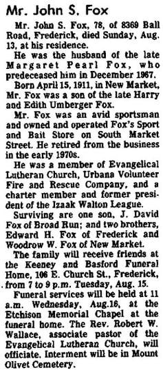
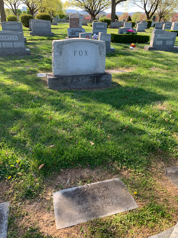
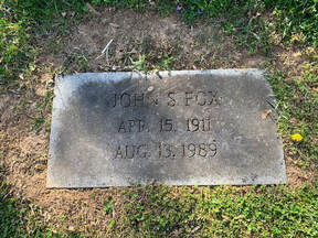
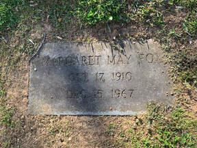
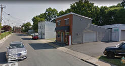
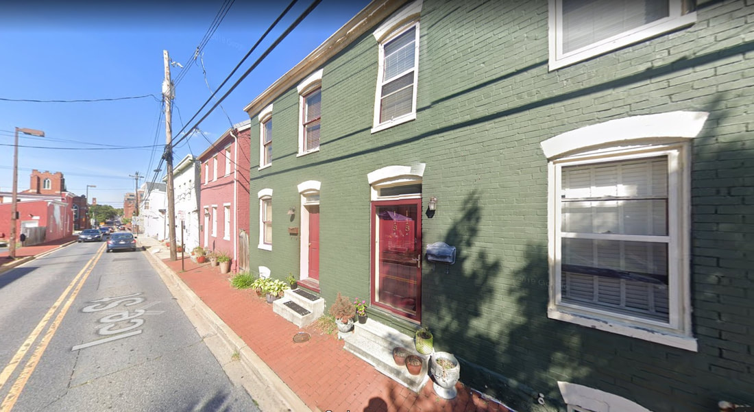
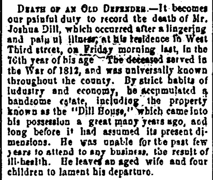
 Dill Avenue in Frederick (c. 1910) Of late, my commute home from Mount Olivet Cemetery to the Rosedale/Villa Estates neighborhood on the northwest side of Frederick has been as quiet as can be. Hey, I’m not complaining, and never have, since I have been so very fortunate to both work and reside here in Frederick for the last 30 years. I know darn well that I am one of the lucky ones having grown up seeing both of my parents commute to Bethesda each work day throughout my childhood. I can usually get to and from work in about ten minutes, and without the aid of major roads or a highway. In fact, I primarily use back streets and alleys, the names of a few may not even register with some readers. And on my way, I only have four turns to make once I leave the cemetery. So join me for my commute home, and I'll give you an impromptu, local-history tour/lesson along the way. Don't worry, we'll be properly "socially distanced," and I'm guessing that most of you have plenty of time to kill while in self-quarantine lockdown.  To begin, for those unfamiliar with the Rosedale/Villa Estates which I call home, it sits just north of Rosemont Avenue, sandwiched between US15 and Fort Detrick. Homes were primarily built here between 1930-1950, providing housing for many newcomers to Frederick employed at "Camp Detrick" during, and after, World War II. These included doctors and scientists from around the country and world, completely changing the cultural fabric of "small-town" Frederick which had been in existence for nearly 200 years up to that point. The neighborhood does have a nice park area and serves home to Frederick's current mayor—so we have that going for us! Fittingly, as you will soon see with this week’s story’s central theme, my neighborhood is best known today for its vehicular “cut-through” streets (linking Rosemont Avenue to West Seventh Street) probably more than anything else. Most of these roadways are named for leading historical figures: Schley Avenue (Admiral Winfield Scott Schley—Frederick boy turned naval commander and hero of the Spanish American War), Taney Avenue (Roger Brooke Taney--Frederick lawyer turned controversial Supreme Court justice), Grant Place (Ulysses S. Grant--Union general during the American Civil War and our 18th US president), Wilson Avenue (Woodrow Wilson--our 28th US president who served during WWI and the 1918 Spanish Influenza pandemic), and Lee Place (Robert E. Lee--Confederate general during American Civil War). Military Road (self-explanatory) runs along the northwestern perimeter of the Villa Estates and neighboring Fort Detrick and there is one more named Biggs Avenue, but that one seems to be a head scratcher. We'll pick that one up later. 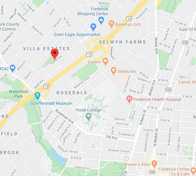 Speaking of streets, those belonging to the City of Frederick are far from bustling at the time of this writing (mid-April, 2020). This has been the case for multiple weeks now, thanks to the mandated state quarantine urging people to stay at home in an effort to curb the spread of the Coronavirus disease/Covid-19. If you are lucky enough to escape your house for a glimpse of life on the outside, you may spot a person or an occasional couple walking along the sidewalk--but I can’t even remember the last time I saw more than ten people gathered together in one place, let alone five. I smile in thinking that just two months earlier I found myself irate and stranded for ten minutes (no lie) trying to make a simple right turn while downtown. I had been doing some history research at C. Burr Artz Library and parked in the adjacent garage late that Saturday morning. I exited the garage okay but ignorantly decided to exit onto S. Market Street (by Wags restaurant). My error was forgetting that it was Downtown Frederick’s First Saturday, and not just any First Saturday, but February’s “Fire & Ice” First Saturday. The city was mobbed with people by the time I had left the library that afternoon! As I said a minute ago, these days, one sees but a few people out along the streets in late afternoon/early evening. They are usually engaged in a brief evening stroll or picking up carry-out from the multitude of busy restaurants and eateries offering "curb-side service." Some folks out walking are donning sneakers and shorts, while others have covered themselves from head to toe while wearing latex gloves and face masks. What puzzles me most is seeing other motorists with face-coverings, and they are the only ones in the car? How are they going to catch, or transmit any viruses while driving? "To each their own," I guess, especially during these anxious and curious times. 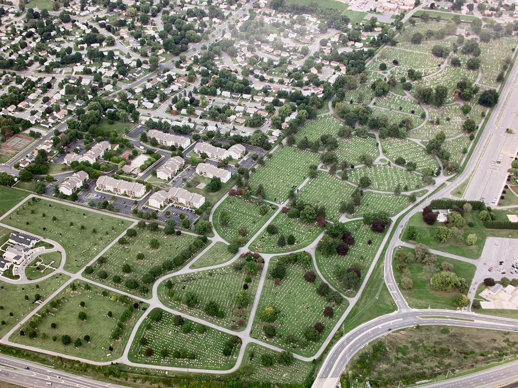 Driving While “Stoned” I knew this sub- title would grab your attention, but it’s not what you think! When I was driving home one day last week, I contemplated upcoming topics for this blog. At the same time, I found myself taking extra notice of the thoroughfare names I utilize each and every workday. More so, I took specific interest in the names behind these streets traveled. It quickly dawned on me that this was somewhat like the “Stories in Stone” blog format itself, in which I research the names on gravestones and make connections to other elements of the community through people's life stories. I figured I could effectively “kill two birds with one stone” so to speak, and figure out for whom these streets are named, and then attempt to find these individuals in Mount Olivet, if they so happen to be buried here. So let's go! LEG 2 — "Frederick's Other City" Here’s an interesting piece of trivia to “wow” your friends and family with: Did you know that Mount Olivet Cemetery contains over eight miles of paved roadways? In addition to serving as a great place to work, visit, learn history and spend eternity, the cemetery is also a fabulous safe-haven for reverent recreationalists in the form of walkers, runners and cyclists. From my office, located within our administration office and mausoleum complex in the south end of the 100-acre burying ground, it’s a 1.3 mile-drive to the Key monument and cemetery's main/front gate positioned off S. Market Street. Call me a rebel, but I refuse to attempt a left turn in afternoon rush hour onto Market Street—doing so would double, or perhaps triple, my entire commute time! .....so says the idiot who wanted to drive on Market Street during "Fire & Ice First Saturday." I choose instead to use our side gate located off Fox’s Alley and Broadway Street. Those who use Stadium Drive each day to accomplish this daring feat (turning left onto S. Market) know exactly what I’m talking about. Interestingly, before I exit Mount Olivet, I've passed by the gravesites of at least four of the street namesakes involved in my commute. In addition, I passed another who isn't a true street namesake, but simply shares a moniker. I also passed a few more stones that have other connections to why things were named the way they are today. Now that I've likely either piqued your interest, or totally confused the heck out of you, let's pick up the second leg/part of my journey as I depart the "City of the Departed." 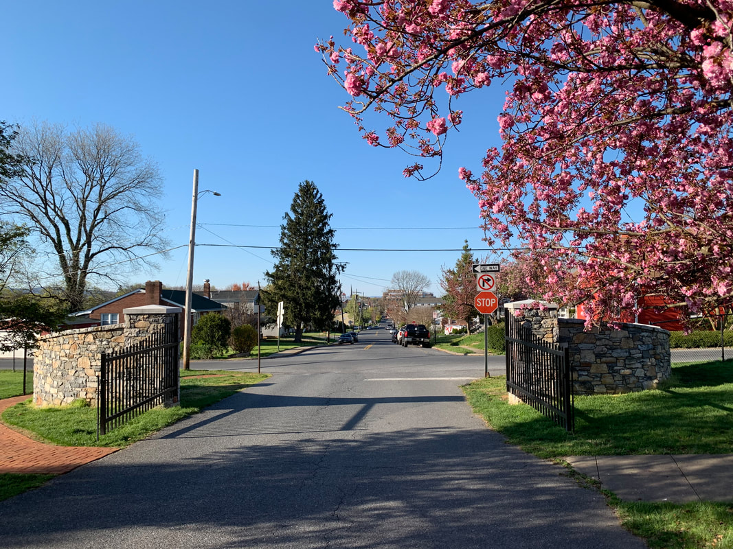 Looking northward at Boadway Street from Mount Olivet's side gate 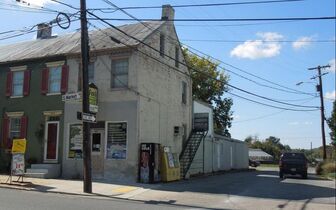 Fox's Alley (and former business) from S. Market St Fox's Alley (and former business) from S. Market St LEG 2 —"On Broadway” Albeit brief, I will include Fox's Alley in my story. I’m usually only on this for 1.7 seconds as I cross over to Broadway Street. Many commuters use this quiet lane (Fox's Alley) on their way home to bypass the stoplight at S. Market and Madison streets. This is a much better, and safer, alternative than those who insist on cutting through the cemetery, especially considering the safety and solitude of our visitors and recreationalists. Yes, we've had some near misses with people speeding on through which has prompted management to close this side gate now in late afternoon. Fox's Alley takes its name from John S. Fox, former proprietor of Fox’s Sport and Bait shop at 501 S. Market. This business just left us last year, but since around 1959 was an ideal place for one-stop-shopping, especially if your wife asked you to stop and pick-up a 6-pack of beer and pound of nightcrawlers on your way home. Mr. Fox (1911-1989) sold the establishment a few years before his death to Bill Offutt, son of local attorney Jerome Offutt. Mr. Offutt was assisted by daughter Lauralea over the years as it kept the Fox’s name for a little bit but changed to Offutt’s Sport and Bait. Recently this property was sold and received a true business makeover, opening as the Stanley Salon. Oh, if Mr. Fox could see it now! When I brought his name up to Superintendent Ron Pearcey, he immediately smiled. Ron knew Mr. Fox quite well and frequented his store regularly over the years, particularly for ice cream and purchasing miniatures for his boss, former cemetery superintendent Robert Kline. This practice, however, came to a halt once Mrs. Kline discovered the ruse of Mr. Kline having Ron make the secret purchases on his behalf. Ron hurriedly left my office for a second, saying, "Hold on Chris, I want to check on something." He returned a minute later and belted out, “February 26, 1964.” I asked, “What about it?” He said that this was the day Mr. Fox bought his burial lots and then proceeded to tell me his funniest remembrance of Mr. Fox, told to him by the previously mentioned, Mr. Kline. Ron said that Mr. Fox approached his old boss (Bob Kline) about buying a gravesite back in the mid 1960s, with the distinct caveat that the location must have a good view of Sugarloaf Mountain. Apparently, Mr. Fox had a decent view of the monadnock from his home on Ball Road south of town. Mr. Kline brought Fox to Area GG/Lot 28 and said, “Will this lot suit you?” At this point, Mr. Fox immediately proceeded to lie down on the ground, and from that vantage point looked to the southeast towards Sugarloaf Mountain. After about a minute, Fox sprang back to up his feet and said to Kline, “That’ll do, I’ll take it!” Mr. Fox’s wife passed in 1967 and was laid to rest here. Mr. Fox wouldn't join her here until August of 1989.
Once on Broadway Street, I usually think about the famed thoroughfare in New York City which becomes the country’s epicenter every December 31st. I sometimes also get a tune instantly playing in my head—the song “On Broadway” of course, performed first by the Drifters in the 1960s, and later covered by George Benson a decade later. I will honestly say that I have never heard the song (“On Broadway”) while actually driving on Broadway Street, but that doesn’t mean that I will continue to suppress the urge sometime to do so in the near future! 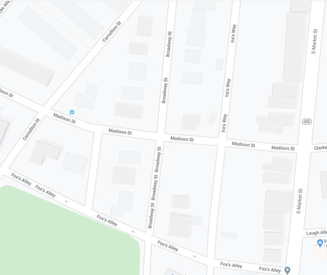 Current-day Google Map of Broadway Street and vicinity I wanted to see what Broadway looked like back on the 1873 Titus Atlas Map which I often reference with my "Stories in Stone" blog articles. Unfortunately, I couldn't find it, well at least all of it.  1873 Titus Atlas Map (Note: the alley running north-south to the left of S. Market is today known as Ira's Way) As you can see in the image above, Mount Olivet appears with the cemetery superintendent's house shaded black, as well as a little gap depicting our front gate off S. Market Street. The side gate would be located above the "C" in cemetery at about the second black line (above) as you can see the alley that constitutes Fox's Alley coming off S. Market.
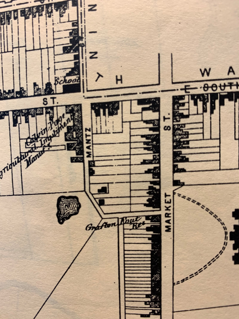
As I drive north, Broadway Street crosses over Madison Street (named for James Madison, our fourth US president) and continues on until it joins a much older portion of road near the intersection with today’s Getzendanner’s Alley (on the east). This was formerly known as Mantz Street in 1873, and this road came off S. Market Street in a westerly fashion and turned north to connect with W. South Street (see Titus Atlas inset below left).
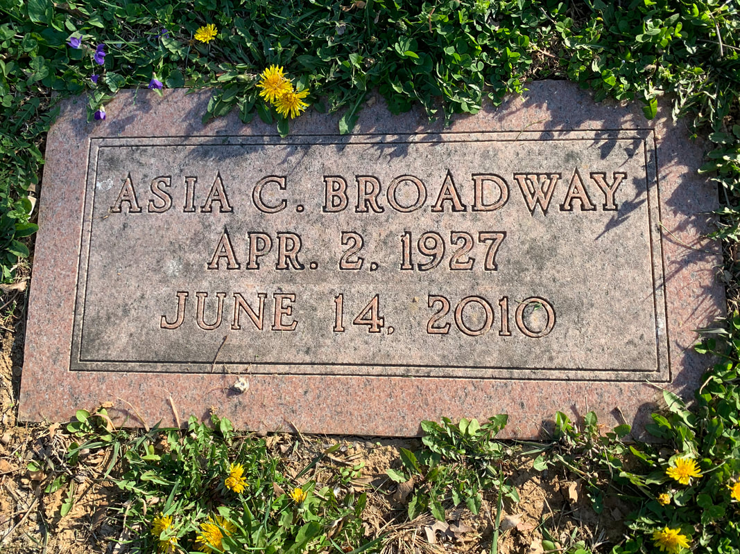
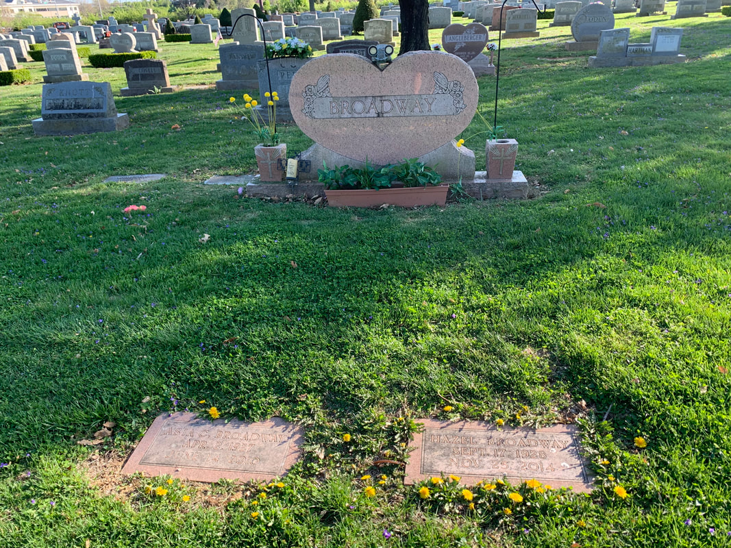
Broadway Street, itself, was not named for anyone in Frederick history, however, we do have a couple buried in Mount Olivet’s Area KK (Lots 51 and 52) by the name of Asia Cooper Broadway (1927-2010) and wife Hazel (Wells) Broadway. Even though Broadway Street does not honor Asia Broadway, I find it quite uncanny that Mr. Broadway was quite successful as a contractor in the paving and blacktop industry. This because of the sheer fact that streets and roadways are at the root, or should I say "route," of our conversation.
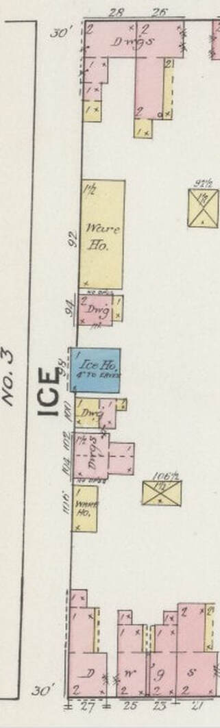
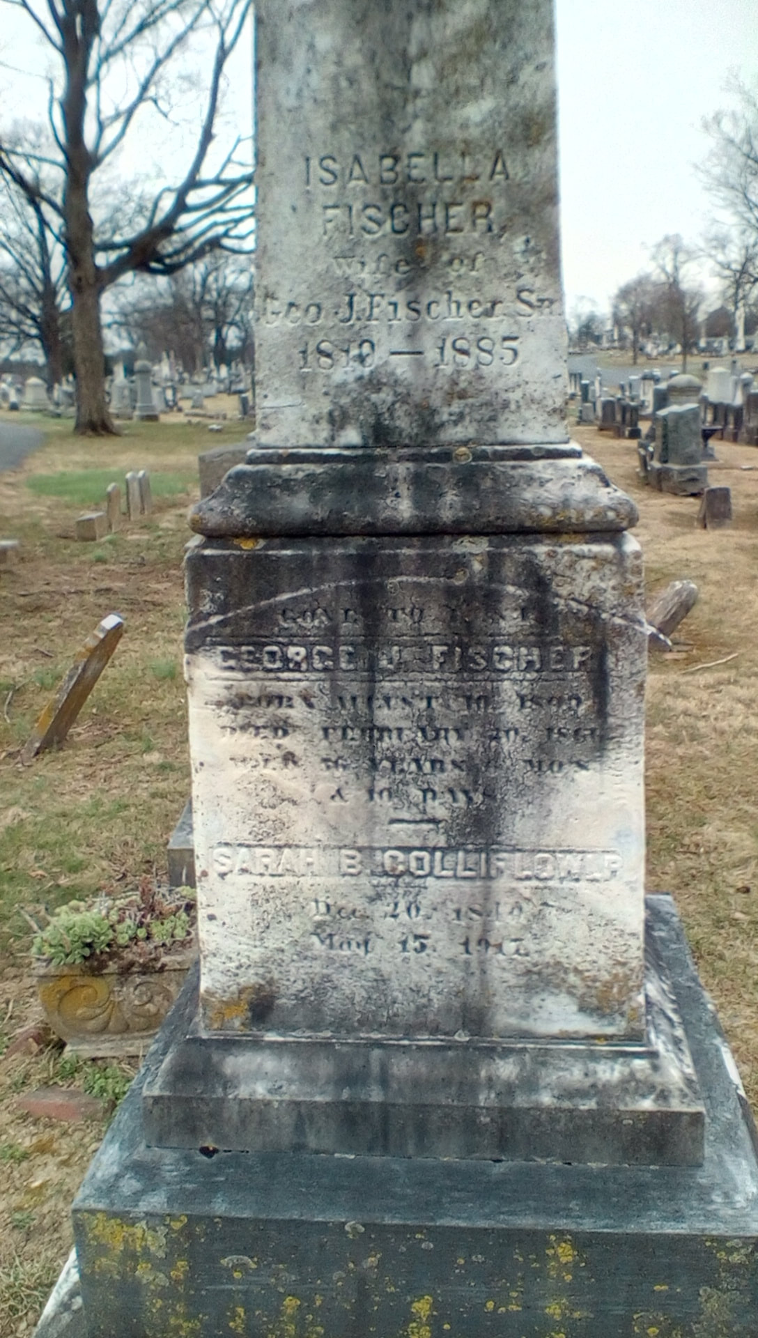
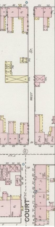
LEG 3 —Ice Cold Beer Now, back to my ride home, and again, the title is alluding to nothing that I am doing behind the wheel on this ride home. As I depart Broadway, I cross over South Street (self-explanatory as this was once Frederick’s southernmost major thoroughfare) onto the coolest street in town--Ice Street. I learned that this narrow lane was originally called Tanner's Alley in an early newspaper article dating to 1832. It was so named for some tanneries located a few blocks north on Carroll Creek. Around the year 1840, an ice house was built by George J. Fischer (1809-1866) as he leased a lot from Elizabeth Hauer, a relative of Barbara Fritchie. The Hauers and Fritchie's were in the glove-making field which certainly was related to tanning. Fischer built his structure on the east side of Tanner's Alley, halfway between W. All Saints Street to the north and W. South Street to the south. Fischer sold his property, known as “Ice House Lot” in 1855, and has continued to be called called Ice Street ever since, although some old deeds still say Tanner's Alley and others say Brewer's Alley. Marilyn found a 1905 deed that refers to the corridor as both: “Ice Street or Brewers Alley.” As we know, the former name would primarily stick to the stretch from W. South to W. All Saints, and Brewer's Alley would adorn the road up until its intersection with W. Patrick Street for most of the 19th century and into the 20th (before becoming Court).
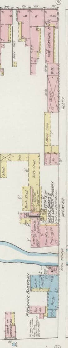
To backtrack, W. All Saints Street is so named for All Saints Protestant Episcopal Church, originally located adjacent E. All Saints Street. The church and graveyard stood atop a hill that was bounded on its north side by Carroll Creek. The Protestant Episcopal congregation moved to a new location closer to the Frederick Court House around 1814, and a new congregation of whites and blacks worshipped together and took over the former location and built what was known as Old Hill Church. This would morph into Asbury Methodist Episcopal and would remain here until about 1921, when it opened a new church structure on the southwest corner of W. All Saints and present-day Court Street. (Note: Today, the original site of the All Saints and original Asbury church locations is the home of a luxury condo development known as Maxwell Place on Carroll Creek. ) 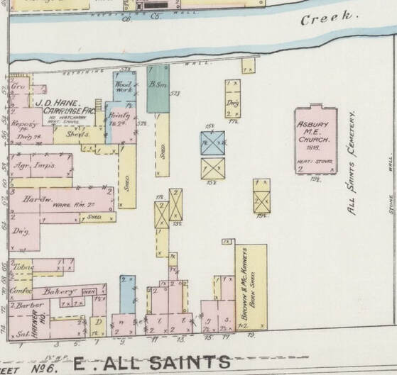 1887 Sanborn Map showing the former site of All Saints Protestant Episcopal Church 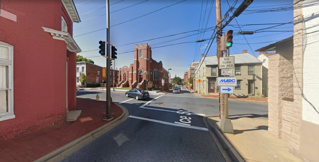 The intersection of Ice Street and W. All Saints Street with Asbury ME on the northwest corner
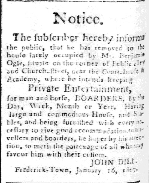
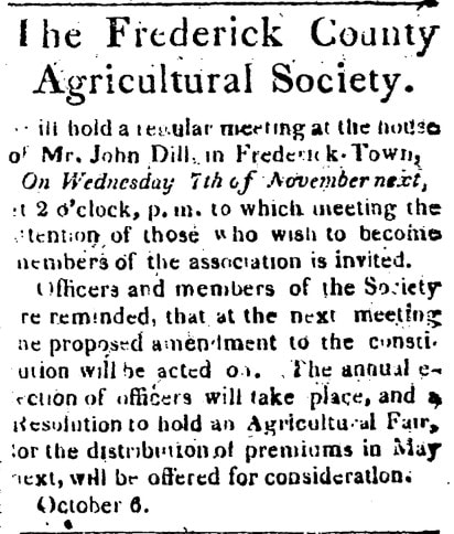
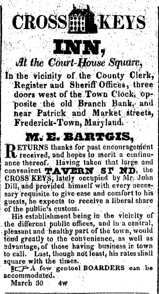
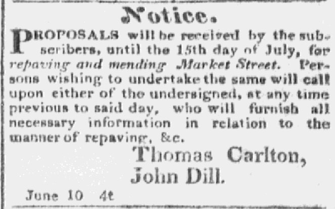
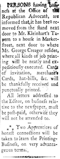
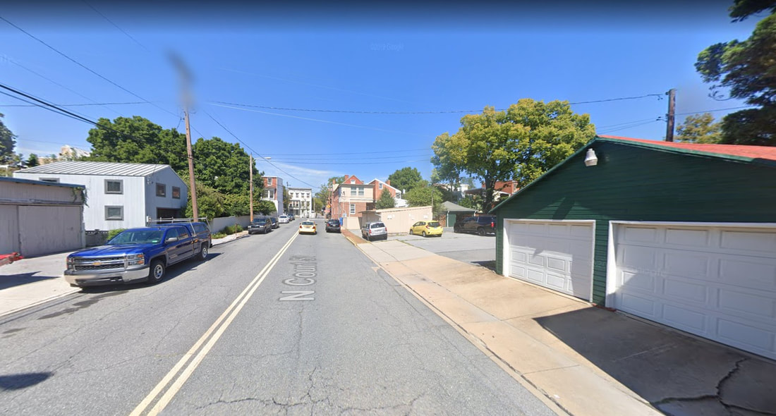
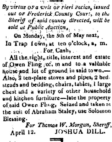
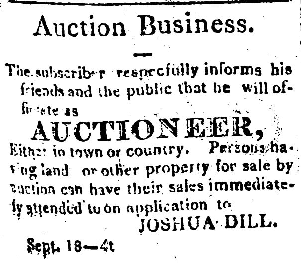
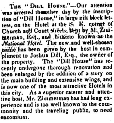
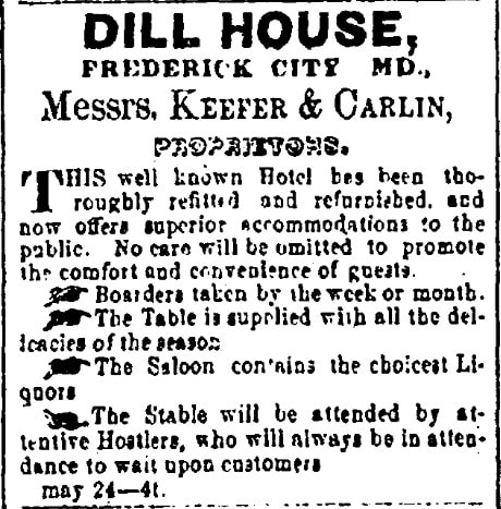
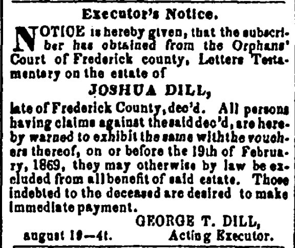
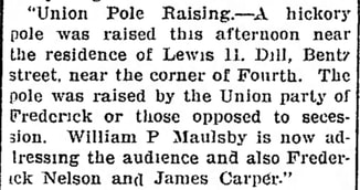
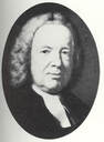 Patrick Dulany Patrick Dulany LEG 4 —The Public's Street I now cross over Frederick’s busiest, and oldest, roadway, Patrick Street, a part of the famed National Road which stretches from Baltimore to Vandalia, Illinois. This is said to have been named by Frederick’s founder, Daniel Dulany, after his cousin named Patrick Dulany (1686-1768), a noted theologian and clergyman of Dublin, Ireland noted as “an eloquent preacher, a man of wit and learning.” 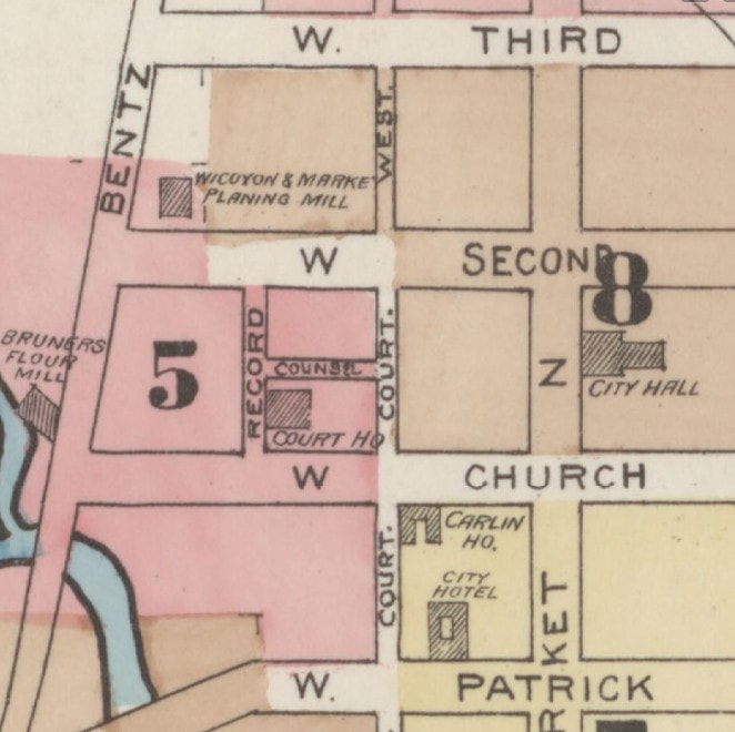 1887 Sanborn Map showing Court Street (formerly known as Public(k) Street 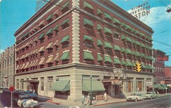 The FSK Hotel in the 1950s The FSK Hotel in the 1950s Court Street continues for another few blocks but was originally known as Public(k) Street/Alley as it dates back to the time of the erection of Frederick County’s first courthouse, today’s Frederick City Hall. This occurred after Frederick became a county in 1748. Founder Daniel Dulany donated the lots for this purpose, and gladly, since his planned development of Frederick-Town would serve as county seat. Travelers on the National Road, and court business called for a profusion of inns and taverns here dating back to the 18th century. Hotels could be found on or near the east side corners of old Public Alley at intersections with W. Patrick and W. Church streets. I recently wrote about Mrs. Catherine Kimball who operated “The Golden Lamb” Tavern on the northeast corner of today’s Court and W. Patrick which eventually morphed into The City Hotel, and later the Francis Scott Key Hotel in 1922—now luxury apartments. 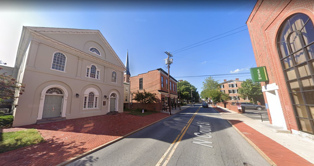 Time out for a sidebar....Remember when I told you that the All Saints Protestant Episcopal congregation decided to abandon their former church structure down on E. All Saints Street to move closer to the courthouse? Well, here is where they went (on the left). This structure was used until the present church, fronting on W. Church Street and around the corner, was built in the 1855. There was another interesting hotel on the SE corner of the former Public and W. Church streets which once stood on the parking lot of today’s M&T Bank. I pull into this parking lot on occasion to use the ATM on my way home. Some residents may recall this as Frederick’s earlier YMCA location, up until the building’s destruction by fire in 1974. Before that, you have to go back to the year 1907, at which time stood the Park Hotel—the final moniker for a very popular lodging location that dated back to the 1700s. We are fortunate to have a beautiful old photograph dating from between 1903-1905, showing the hotel and adjacent area. 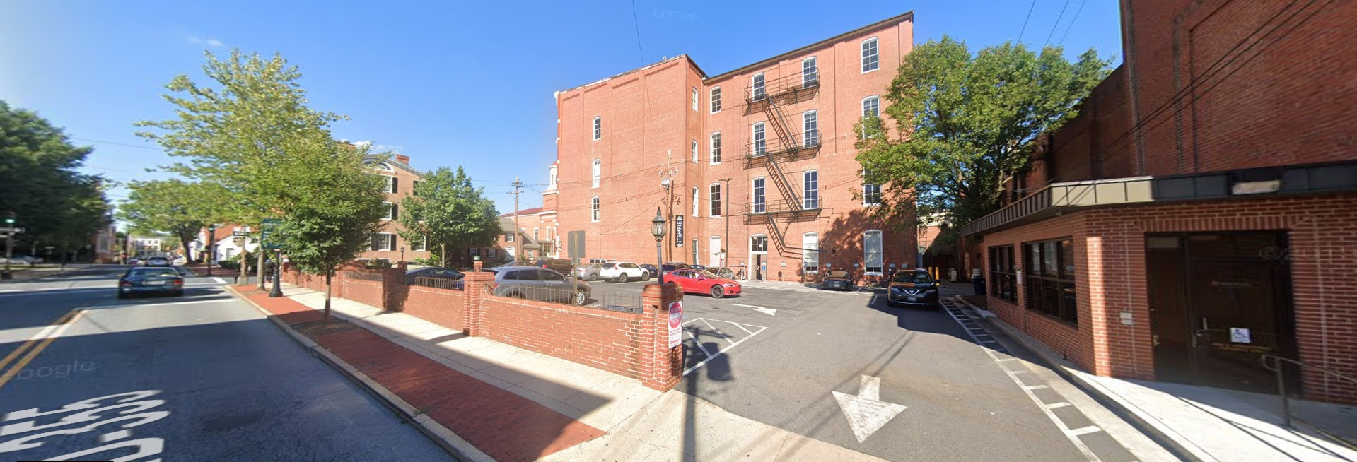 The scenic M&T Bank parking lot as seen from Court Street 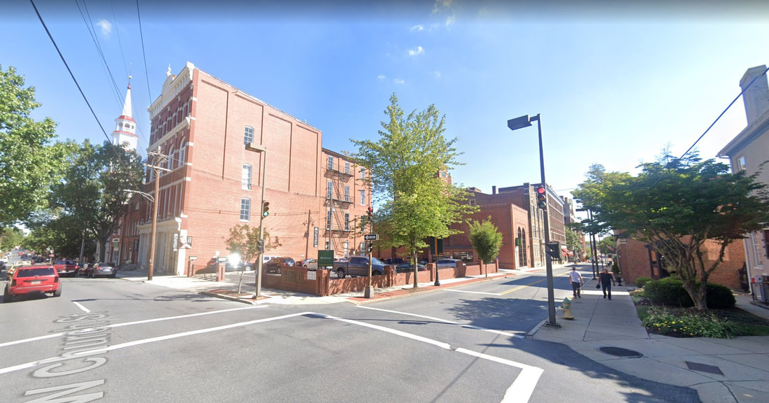 Looking southwest at the intersection of Court and W. Church streets 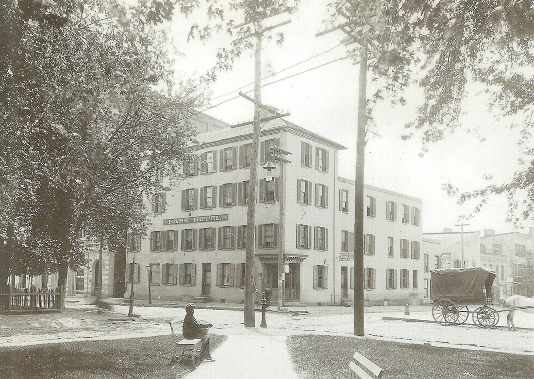 The Park Hotel (c. 1903) The building would be demolished in 1907 to make room for the Young Men’s Christian Association which opened the following year. Preceding the Park Hotel, the structure took the name of the Carlin House, whose story will be told in a future article in context to proprietor Frank B. Carlin. 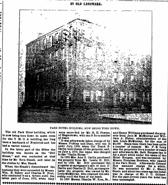 Frederick News (Jan 19, 1907)  1765 Stamp Act Repudiation 1765 Stamp Act Repudiation The roots for inns and taverns run deep at this location, a funny thing to say considering that "The Temple," a Paul Mitchell Partner School for hair design, is located next door these days. The first apparent petition to the county court for a license to operate a tavern in Frederick was made by Cleburn Simms, who presented the following petition in March, 1749: "That your petitioner, having provided himself with accommodations fit for travelers and others, humbly prays that Your Worships would be pleased to grant him a license for ordinary keeping, he complying with the Act of Assembly in that case provided and he as in duty bound will pray." The petition was accepted by the county court justices, and the site of the Simm's tavern was built right here at this location of the M&T Bank and Temple parking lot. When Mr. Simms died, his widow Mary became the first female to hold an innkeeper's license. It is thought that this same location came into the ownership of a gentlemen named Samuel Swearingen who hosted the grand celebration dinner following the mock funeral of the 1765 Stamp Act in late November, 1765. The county court justices were all for taverns as we can see, but had little use for stamped paper from Great Britain. One way or another, the site of Swearingen's Inn at this location eventually became a private residence owned by a man named Benjamin Ogle. Later, another man named John Dill would come into the picture and be responsible for giving Frederick Town “The Dill House." This was purchased from Robert Miller of Baltimore on December 11th, 1806 for $2,450. John Dill (1762-1841) was of German heritage and could have come to Frederick by way of Pennsylvania. He operated his tavern stand here starting around 1807 and this would also come to be known as "the Cross Keys Tavern." From reading old newspapers, Dill’s Tavern seemed to be the premiere site for sheriff’s auctions, entertainment events, and organization meetings ranging from bank boards to the county’s Republican Committee to the Frederick Agricultural Club who put on the first cattle shows and fairs. This was even a site of special mayor & alderman meetings, as well as serving as a municipal election precinct. Mr. Dill eventually turned hotel management over to Mathias Bartgis in 1826.
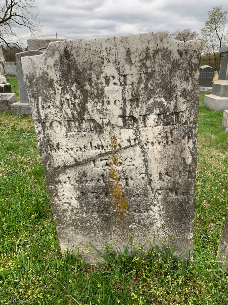
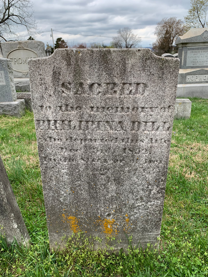
 Dill's Tavern is depicted in the 1854 Sachse lithograph of Frederick as the yellow building (front and center) along W. Church St and to the immediate left here of Public St John Dill married twice. His first wife was Catherine Peltz, a widow and daughter of George Burkhart. The couple wed in 1790 and would have three known children to live to maturity: Joshua (b. 1792), Ezra (b. 1795), and Elizabeth (1800-1866), the latter marrying a man named Levin Thomas. After Catherine's death on October 4th, 1804, John Dill would eventually wed another widow, who had been married to a fellow named Henry Fout. Her name was Philipina, and her maiden name was Philipina Krieger, daughter of another tavern owner in town (George Krieger/Creager, Sr. (1752-1815). John Dill was civic-minded and served as a roads and street commissioner of town. He continued to own the tavern property throughout his lifetime, but leased it out to others to run. Upon his death in 1841, his will would convey the popular hostelry to his son, Joshua. Mr. Dill was originally buried in the Evangelical Lutheran burying ground behind the church within two blocks to the east of his tavern. His descendants would move his remains to Mount Olivet on September 20th, 1870. He was buried in Area H/Lot 327. His second wife, Philipina, would be reburied here as well on the same day.
At 49 years of age, Joshua Dill had been involved in the hostelry business for a good part of his life. In fact, in addition to gaining experience from his father’s success in the trade, his father-in-law was also a prominent tavern keeper in town. This is a perfect segue to get back on Court Street and continue my ride home.
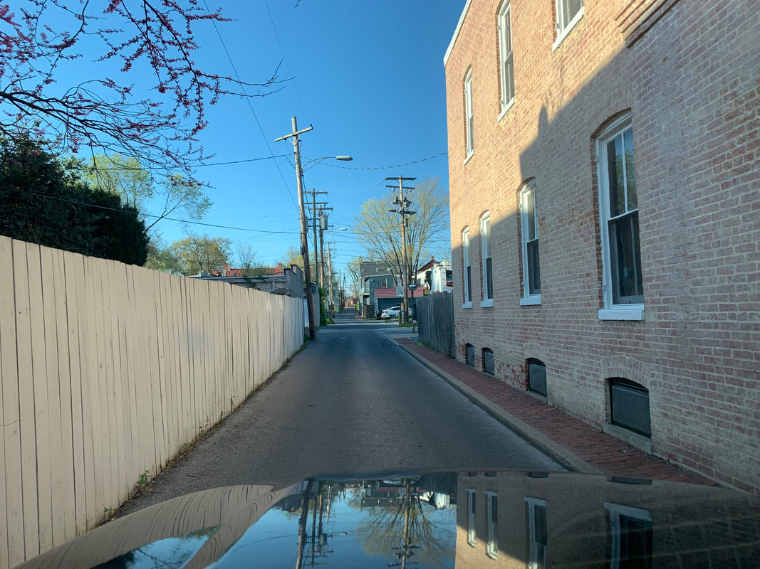
 Looking north from Court Street at the intersection with W. Second Street. As I drive over W. Second Street, the street sign says that I’m still on Court Street. The road bed actually widens enough to allow for parking on both sides as I enter this new through-way. Up until the 1930's, this used to be called Kleinhart's Alley, a unique name that has a direct link with the fore-mentioned Dill family. You see, Joshua Dill (son of the previously mentioned innkeeper John) was married to Mary Kleinhart, the daughter of a Hessian mercenary soldier who was fighting under the British flag during the American Revolution. Johann Franz Kleinhart (born in 1751 in Hesse-Kassel) was likely captured in New Jersey at the Battle of Trenton. This small, but pivotol, battle took place on the morning of December 26th, 1776 in Trenton, New Jersey. After Gen. George Washington's crossing of the Delaware River north of Trenton the previous night, the iconic hero led the main body of the Continental army against Hessian auxiliaries garrisoned here. After a brief battle, almost two-thirds of the Hessian force (800-900) were captured, with only negligible losses to the Americans. The battle significantly boosted the Continental army's waning morale, and inspired re-enlistments. Kleinhart and other German soldiers were imprisoned at various sites. In his case, Franz Kleinhart would be brought to the Frederick-Town Barracks, a military installation located atop Cannon Hill, today’s site of the Maryland School for the Deaf. The concentration of these German mercenary soldiers led to it receiving the lasting nickname of Hessian Barracks. Kleinhart may have even been involved in constructing the barracks which seems fitting as I have seen a few references to him perhaps possessing talent as a stone mason. 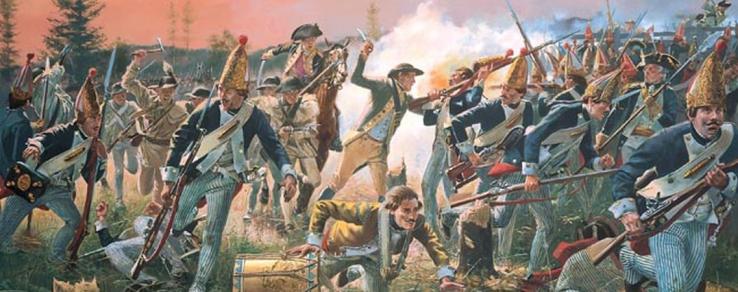 Hessians on the run in the Battle of Trenton (Dec, 1776) 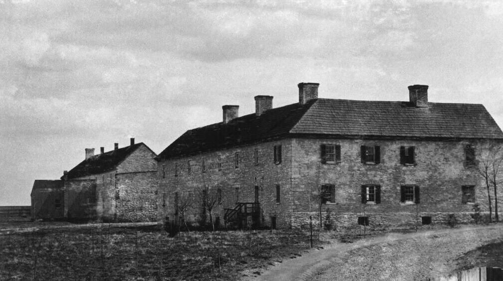 Frederick "Hessian" Barracks Like several other Hessians in captivity here during the war, Franz, or Francis (as his name would become Anglicized) decided to stay in Frederick once released at the end of the war in 1783. There were plenty of pretty German girls around and Kleinhart married a woman named Maria Salome Weltzheimer. The couple had a son named John Frederick in 1787, and two daughters: Mary Matilda in 1794 and another named Wilhemina in 1799. Herr Kleinhart operated a tavern on the southside of E. Second Street near the town's early gaol (jail) and later another on W. Third Street. In Rev. Frederick Weiser’s book Frederick Maryland Lutheran Marriages & Burials 1743-1811, I found references to a number of marriages performed at Kleinhart’s Tavern between 1803 and 1805. 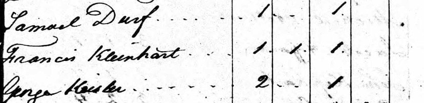 1790 US Census showing Francis Kleinhart living in Frederick 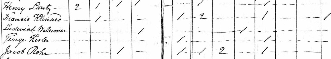 1800 US Census
 1820 Census
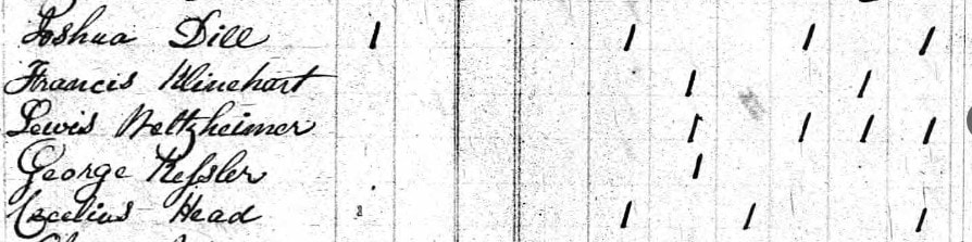
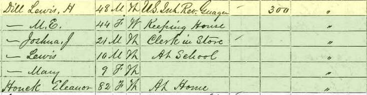
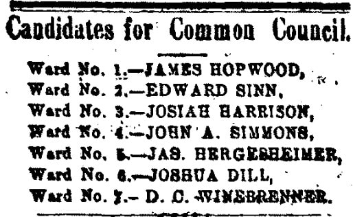
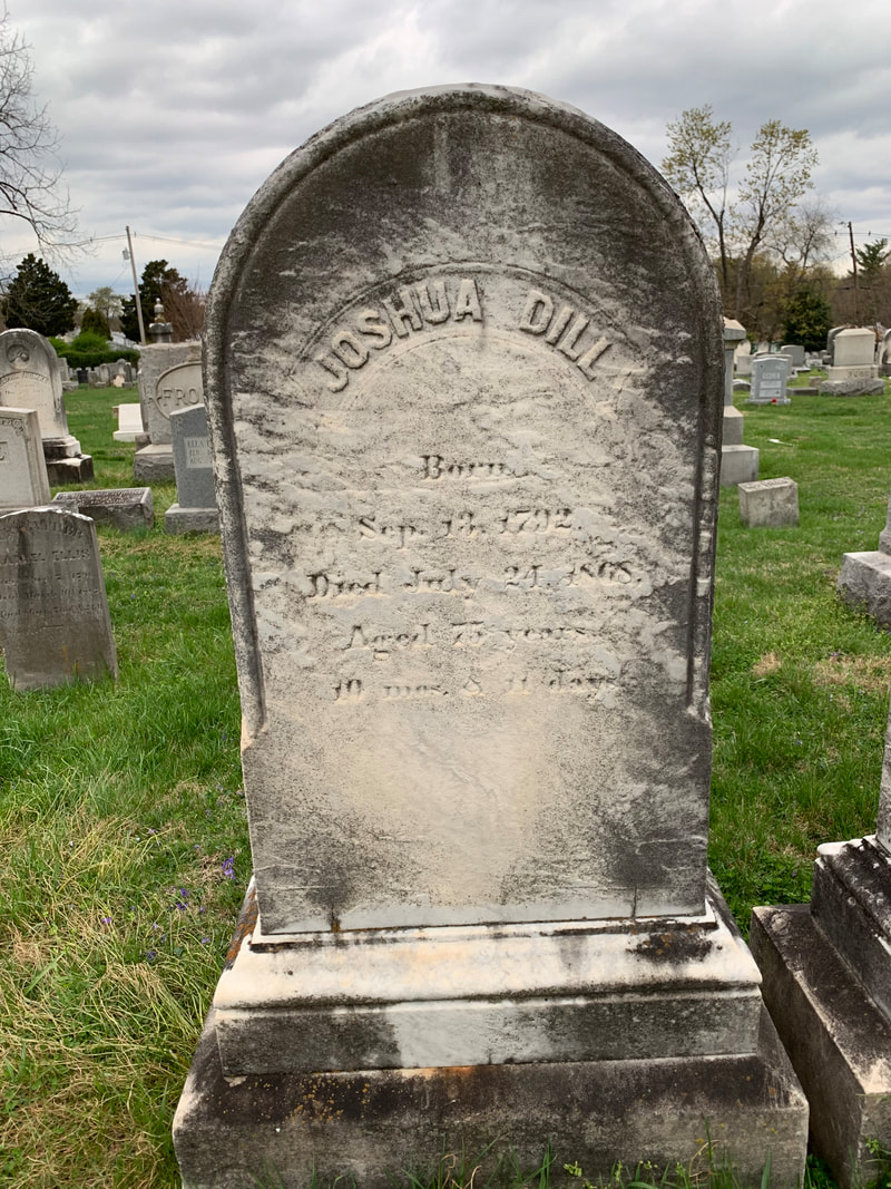
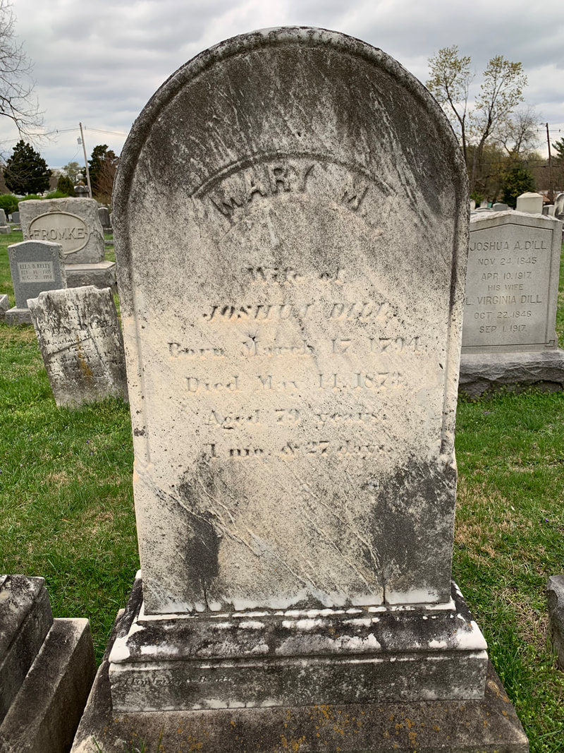
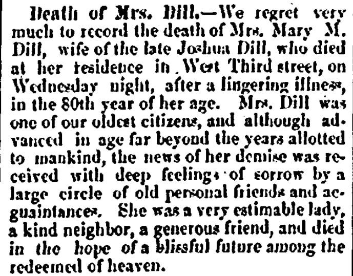
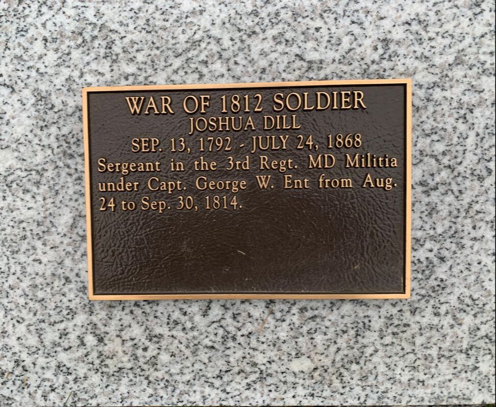
In 1827, Maryland newspapers carried the story of a terrible fire at Mr. Kleinhart’s residence in early June, 1826. Reported as the worst fire in Frederick Town up until that time, the blaze started mysteriously in Francis Kleinhart’s stables located along the alley between W. Second and W. Third streets. The fire spread to consume a number of nearby dwellings including that of Klinehart who was sharing his home with daughter Mary and her husband Joshua Dill. Kleinhart's brother-in-law, Dr. Lewis Weltzheimer, lived next door and his apothecary business fell prey to the flames as well. 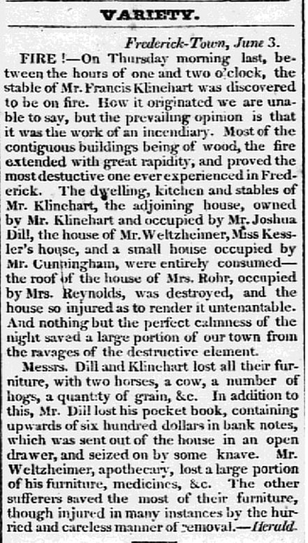 Hagerstown Torch Light (June 8, 1826)  News of the fire made newspapers all over Maryland including Baltimore and Easton. Frederick’s Jacob Engelbrecht wrote of the “dreadful fire” in his famous diary in an entry on June 1st, 1826. He would have known Mr. Kleinhart quite well as his own father, Conradt Engelbrecht, was also a Hessian soldier held captive at the Frederick Barracks during the Revolutionary War. I was, however, surprised to see the following written on June 3rd, 1826 by the man who seemingly had his finger on the pulse of Frederick: “Frederick Kleinert, son of Mr. Francis Kleinert was this day brought before the Mayor George Kolb & M. E. Bartgis & George Rohr Esquires on suspicion of being the incendiary of the fire of the 1st instant and after an investigation of 2 or 3 hours was committed to prison to stand his trial at the next County Court. It appeared in evidence that he had threatened to consume the whole fabric owing to some difference between himself and his father bye the bye Fred, is a very bad boy. PS. Clip & clear not indicted 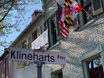 I don’t know what became of Frederick Kleinhart, but assume that he eventually moved away from the area as I haven’t located a grave or obituary. He married Catherine Wiegle in 1813, and all I have been able to find relating to him is a marriage record and (Engelbrecht) diary notation for his daughter Susan Kleinhart (Faubel). He last appears here locally in the 1840 US Census, apparently living in Frederick. Francis Kleinhart, alley namesake, died the following year on September 14th, 1827 and was buried in or next to Frederick’s first Presbyterian Church cemetery. This sacred ground was once located by the congregation's meeting house on the southeast corner of N. Bentz and W. Fourth streets. Jacob Engelbrecht made note of his death and added that “he was buried in a vault made by himself for that purpose in his lot adjoining the English Presbyterian graveyard without a ceremony.” 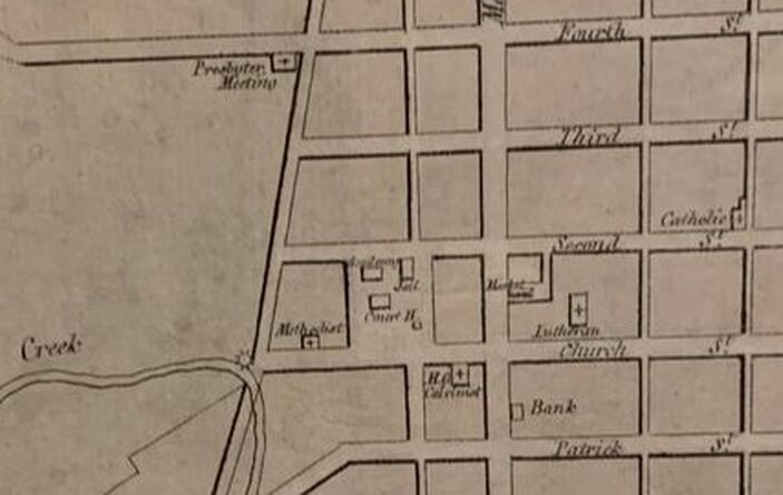 The original Presbyterian Meeting House can be seen on Varle's 1808 map in the upper left corner with its location on the southwest corner of N. Bentz and W. Fourth streets. 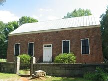 The author imagines that the Presbyterian Meeting House looked similar to this one pictured here and built in the same era The author imagines that the Presbyterian Meeting House looked similar to this one pictured here and built in the same era Frederick's original English Presbyterian Church was constructed in 1780 and built of brick and boasted "high backed pews, a lofty pulpit, and a brick floor." A new house of worship was completed in 1825 on W. Second Street, but the original graveyard remained active until 1885, at which time the trustees decided to discontinue use. The old structure was utilized afterwards as part of an old factory until being sold, along with the cemetery ground, to the Salvation Army for $400 in 1887. Most of the bodies here were removed on May 10th, 1887 and transferred to Mount Olivet. These were originally placed in Area Q, but later moved to Area NN on December 12th, 1907. Among these was the old Hessian Kleinhart, who is said to rest in Lot 131/Grave 11. He doesn’t have a stone, as it likely disappeared along the way, not uncommon as broken or worn stones were seen as unsightly elements here in Frederick’s “Garden Cemetery” back in the day. 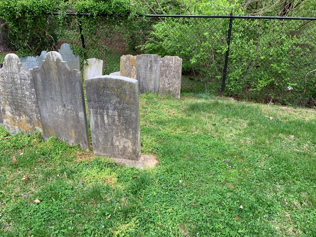 According to cemetery records, the mortal remains of Francis Kleinhart are said to be located to the immediate right of Mary Davidson in the first row of stones here in Area NN/Lot 131 Mary (Kleinhart) Dill and her husband, Joshua, repaired/rebuilt their home and lived on West Third Street until their respective deaths—the house still stands today at 102 W. Third Street. We are lucky to have a bit more info on Joshua thanks to a publication that the cemetery undertook in 2014 with the bicentennial of the War of 1812, entitled Frederick’s Other City: War of 1812 Veterans: Sergeant Joshua Dill served under Capt. George W. Ent, 3rd Regiment, Maryland Militia, from August 24 to September 30, 1814. Joshua Dill was born September 13, 1792 in Frederick to John (of “Dill House”) and Catherine Burkhardt. He was married to Mary M. Kleinhart on April 12th, 1817 in Frederick. Joshua died July 24, 1868 at the age of 75. He was laid to rest in Mount Olivet Cemetery in Area H/Lot 327. Mary was born March 24, 1794, and died May 14, 1873 at the age of 79. She too was buried in the same lot as her husband. Joshua held the following positions within Frederick City: A constable in December 1820, May 1825, and June 1833; Deputy Sheriff in October 1821; Lutheran Church warden in January 1824 and an Elder in January 1833, January 1841 and January 1844; a councilman for Ward #6 in February 1834, February 1862 and February 1863. He was the owner of the Cross Keys Hotel, which became known as the Dill House, located southeast of the Courthouse.
Joshua and Mary Dill had six known children. First was John Francis Dill (1819-1891), Lewis Henry Dill (1821-1894), George Theodore Dill (1823-1888), Henrietta (Dill) Wisong (1826-1872), Hirame Dill (1828-1829) and Mary M. (Dill) Schultz (1830-1861). Here are census records showing Joshua and Mary Kleinhart Dill's family living on W. Third Street: 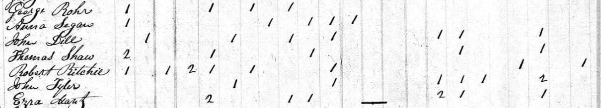 1840 Census 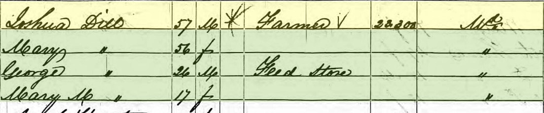 1850 US Census Joshua Dill passed on his father’s tavern enterprise to his son, Lewis Henry Dill. As mentioned earlier, a gentleman named Frank B. Carlin entered the picture in the mid 1860s as he was hired to be the manager in 1867. Lewis Henry Dill would eventually sell the property to Mr. Carlin's widow, Ann Cecilia, in 1885, completing an 80-year ownership of this endeavor which had previously changed its name to the Carlin House in 1879.
The Dills, primarily Joshua, did a great deal of buying and selling of land in and around Frederick City. He had ample opportunity during his terms as sheriff, as people regularly were put in the position of hastily unloading their holdings to pay outstanding debts. The lion’s share of these auctions occurred at the Dill House to boot. Joshua Dill and his children benefited greatly. In his later years, the former sheriff and innkeeper put his efforts toward farming, as he had plenty of parcels to care for.  1860 US Census Joshua Dill died on July 24th, 1868 and wife Mary, daughter of the old Hessian, passed on May 14th, 1873. A notation in our cemetery records says the following: "REMOVAL from the Dill's Cemetery where he was originally buried on July 25, 1868." I haven't been able to find a reference to a "Dill's Cemetery" but have a theory that it could be a reference to a plot within or adjacent the Old Presbyterian graveyard where his father-in-law (Francis Kleinhart) was buried. Regardless, Joshua Dill was removed to Mount Olivet and reburied in the Dill family lot on November 24th, 1869. His parents would join him here a year later as previously stated.
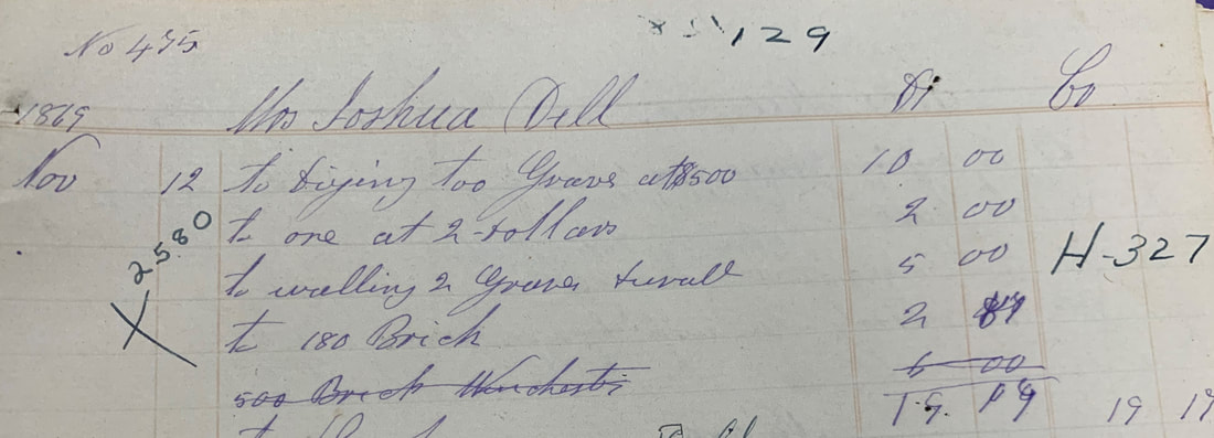 Dill gravelot purchase and work as recorded in Mount Olivet's interment book in Nov 1869. This was made possible by Mrs. Mary Kleinhart Dill who moved her husband and in-laws to Mount Olivet from other cemeteries
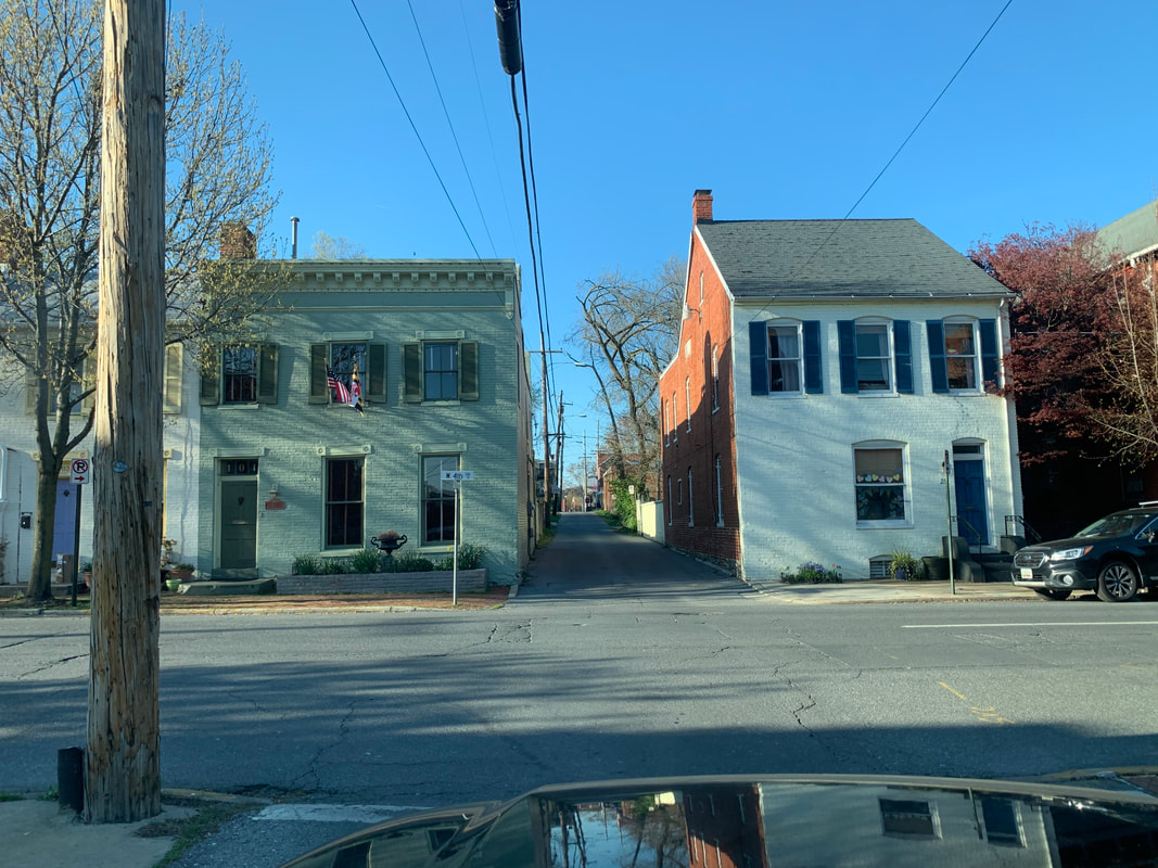
 Former Kleinhart/Dill homesite on SE corner of W. Third and Court streets Unlike the hotel, the other "Dill House," the home of Joshua and Mary Dill, stayed among the family and descendants until 1979. I found an ad offering the dwelling for by son George and son-in-law Theodore Schultz. Cooler heads must have prevailed, or a relative stepped up with the cash to purchase. 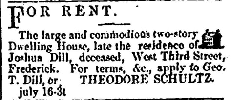 Frederick Examiner (July 16, 1873) 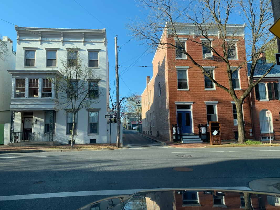 As I pass the old Kleinhart/Dill residence on my right, I cross over W. Third Street and find myself in a "tried and true" portion of virtually unaltered Klineharts Alley.
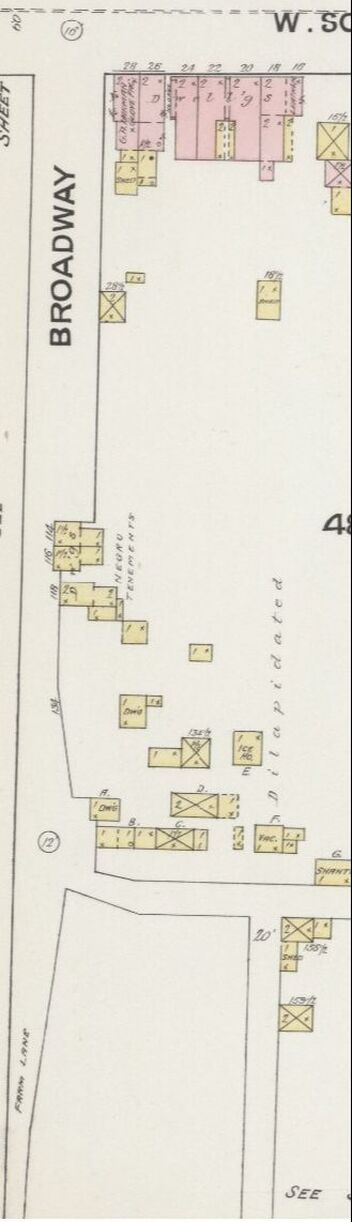
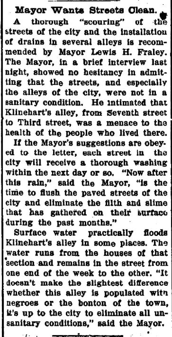
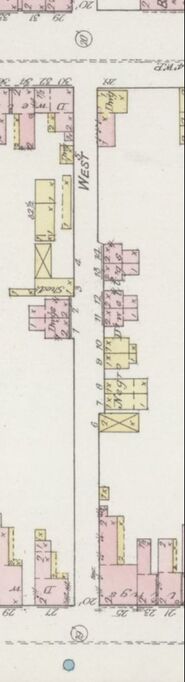
I can’t travel the alley to its terminus at W. Sixth Street because I’m soon forced to take my first turn of the commute trip home—a left onto W. Fourth Street. In researching for a Frederick-based, Black history documentary project nearly 25 years ago, I learned that many African-American/Black residents lived along Klineharts Alley between W. Fourth and W. Seventh streets. A derogatory moniker of sorts once used as the name for a cluster of dilapidated shanties and shacks that once stood along the alley was Santa Domingo. I don't know if the Blacks here were actually of Haitian origin or not. The narrow roadway was usually in terrible shape and often flooded, prompting a former mayor's ire and municipal help. I could judge this from an article found in the Frederick News from 1914.
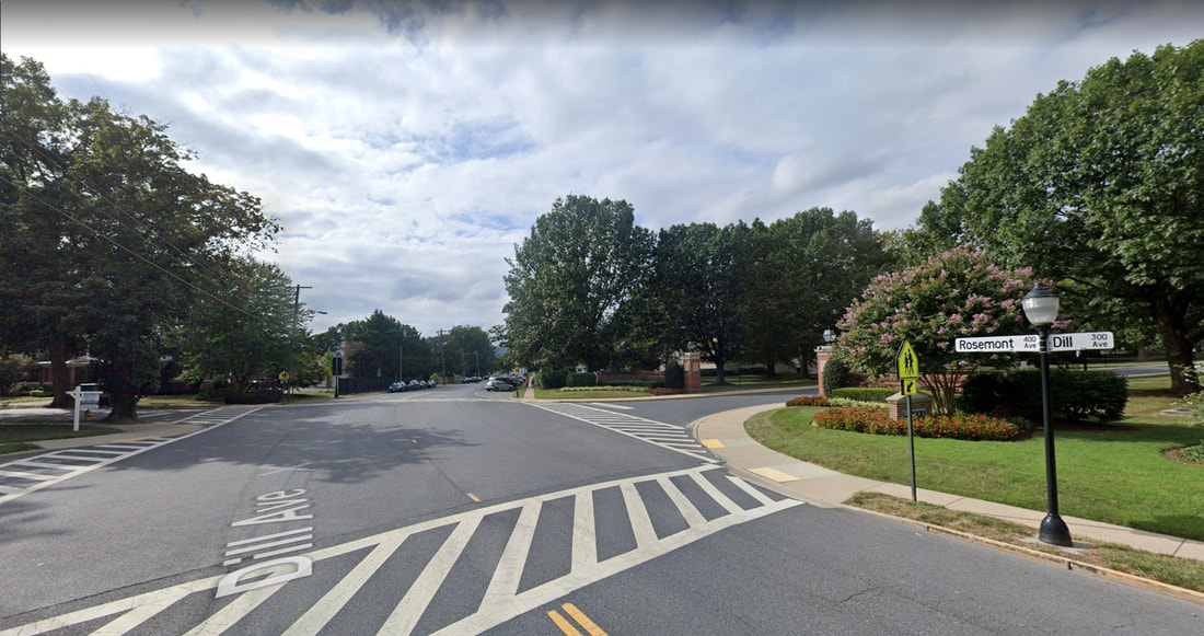
LEG 4 —"Dilly, Dilly" 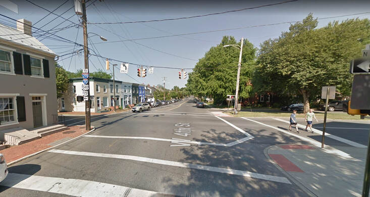 Looking west on W. 4th Street at the intersection with N. Bentz Street and beginning of Dill Ave Once on W. Fourth Street, I soon come to a stoplight at the next cross-street of N. Bentz Street. I won’t get into the name Bentz at this time, but here was another family with deep German roots in town and a namesake mill located at the southern portion of this intersecting roadway at Carroll Creek. A glance to my left toward the southwest corner of the intersection shows me a row of townhouses where the original English Presbyterian Meeting House once stood. Of course this was before the site became home for a number of years to the Salvation Army. The property sold again and was developed into townhomes on both corners. Francis Kleinhart, and perhaps son-in-law Joshua were once buried in the adjacent church graveyard as I remarked earlier. It all seems to come full circle as I cross Bentz Street and find myself heading west on Dill Avenue. Now where in the world did that name come from? You can guess by now...or you sure as heck better be able to!
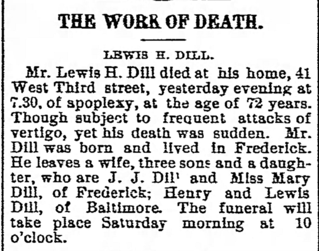
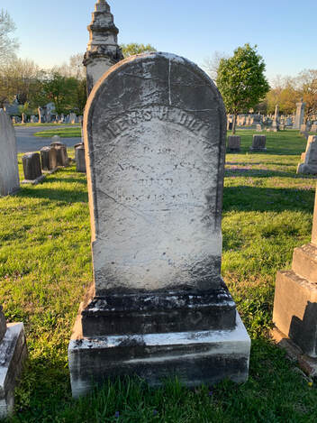
 1870 US Census 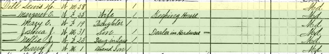 1880 US Census 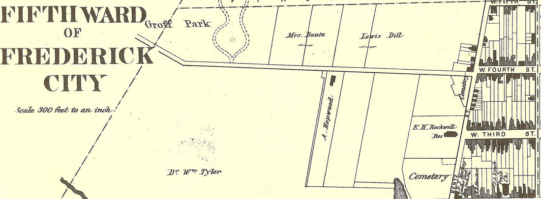 1873 Titus Atlas map showing Lewis Dill's property on north side of Almshouse Road (later Dill). Note the Presbyterian Cemetery shown on this map at N. Bentz and 4th streets. Groff Park would become Hood College. The 1873 Titus Atlas clearly shows land parcels owned by Dill. It wouldn’t be until August, 1901 when Frederick alderman John Baumgardner suggested the name of Dill Avenue to replace the W. Fourth Street Extended moniker. It was duly accepted, and the rest is history. As for Lewis Henry Dill, he made his living as a farmer and large landholder thanks to previous generations of “Dill”igent business persons. He is buried in Mount Olivet's Area G/Lot 32. 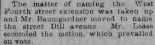 Frederick News (Aug 22, 1901)
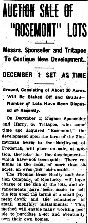
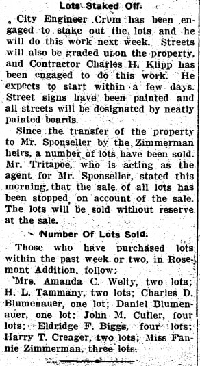
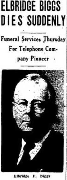
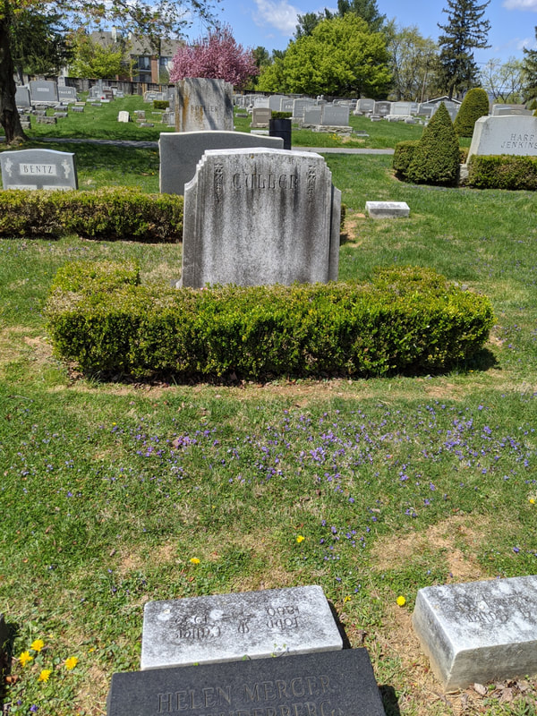
 Heading northwest out of town, Dill Avenue suddenly becomes Rosemont Avenue once you pass Hood College. The name Rosemont comes from a poultry farm, and later subdivision, of the same name. The neighborhood was laid out in 1913 by Eugene Sponseller and Harry Tritapoe, the latter being the poultry farmer. Two gentlemen of particular interest in the Rosemont story are Elbridge F. Biggs and John M. Culler, who jointly bought eight building lots here in 1913. Their purchase constituted the entire 1st block of Fairview Avenue, north of the newly named Rosemont Avenue which came with the development.
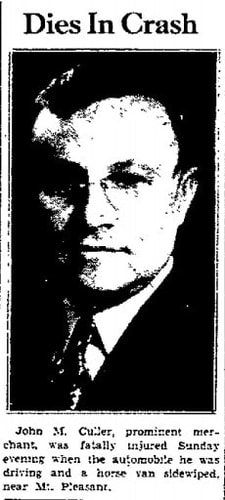
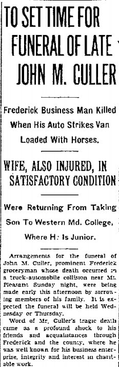
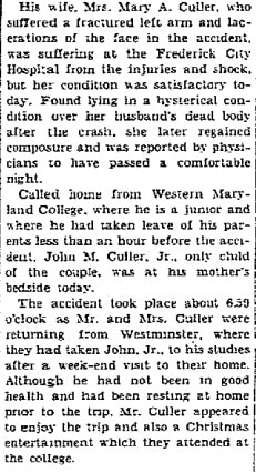
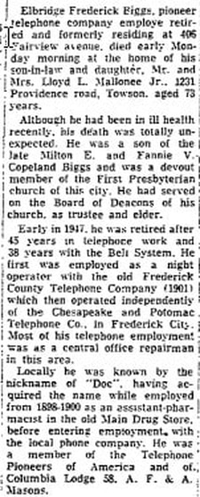
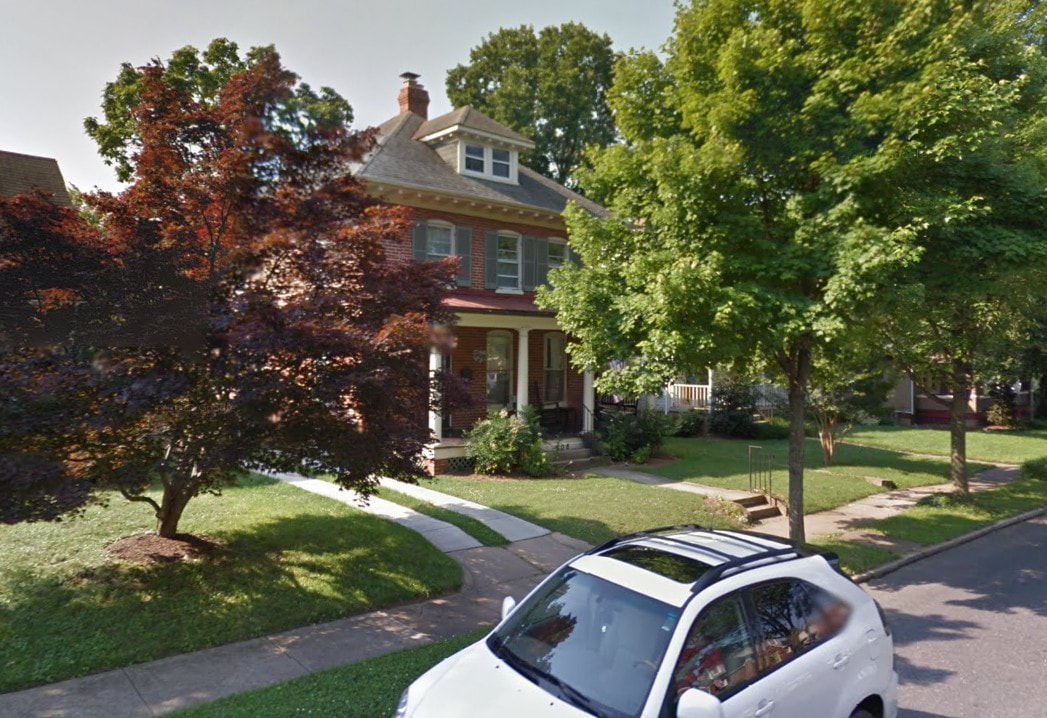
John McCleary Culler (b.1880), was a grocery store proprietor, and Elbridge F. Biggs, Jr., the switchboard manager for Chesapeake & Potomac (C&P) Telephone Company. In addition to being successful businessmen and civic leaders, this tandem were brothers-in-law as Mr. Culler was married to Mary Ada Biggs, Elbridge’s sister. The Cullers lived on Elm Street and the Biggs took up residence on Fairview Avenue which was the principal street of the Rosemont development, which didn't go any further to the west. 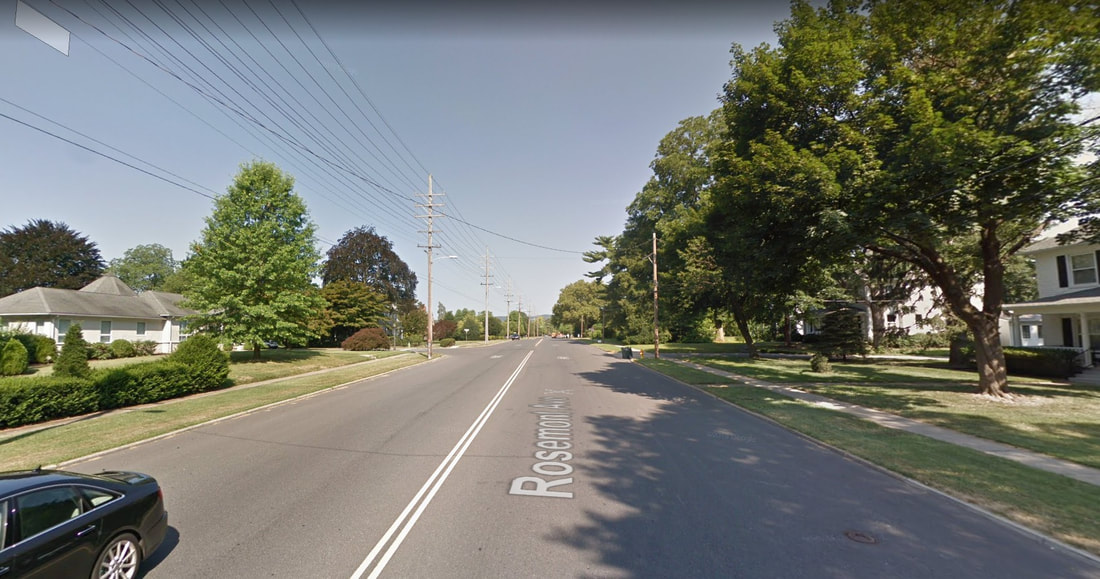 Rosemont Ave 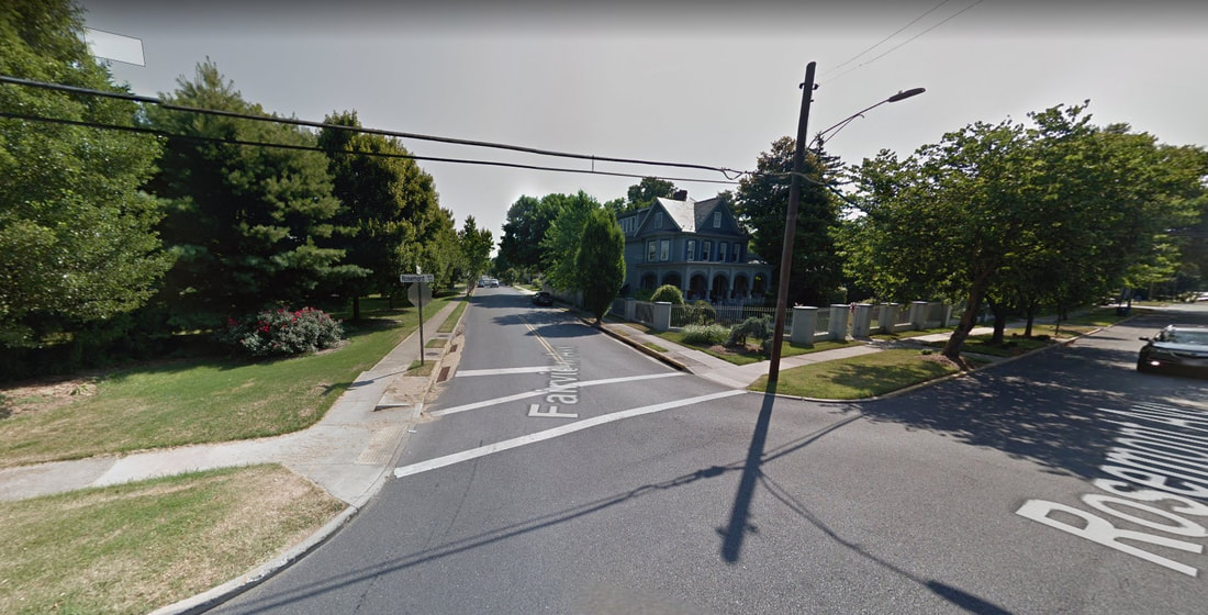 Fairview Ave As far as Rosemont avenue, the road had been unofficially called the Montevue Turnpike, a crude translation to French of “Mountain View,” leading to the county almshouse of the same name as mentioned earlier. Rosemont Avenue became the new name as it ran past the new development. The transition between Dill and rosemont avenues occurs at a major bend in the roadway, exactly in front of Hood College's main gate. From a timeline perspective, the college campus here opened in 1913, moving from downtown's Winchester Hall. The cross streets here along Dill and Rosemont are mostly named for college connections (ie: College Avenue, College Terrace, College Parkway, Hood Alley), scenic vistas like the fore-mentioned Fairview, and trees/plants (ie: Elm Street, Ferndale, Magnolia Ave). A few more exist like Lindbergh and Grove. Lindbergh was named for the heroic aviator, but I don’t know if Grove paid homage to trees, or the local family of the same name. Scottish Alley is a story unto itself as well, and I will leave it alone for now. However, there is one additional street name that irks me more than any other--Dulaney Street. This is the only tribute we have to the founder of Frederick Town/City and Frederick County. It's more or less an alley, and should be spelled Dulany as this was the way the man spelled his name. The pathetic lane connects Dill Avenue to W. Second Street, running two measly blocks. For God's sake, I've done far less for Frederick over my lifetime, but have a prominent thoroughfare named for me in Christopher's Crossing. LEG 4 —"Bigg Deal" As I slowly approach the terminus of W. 2nd Street as it ends in front of Frederick’s oldest home, Schifferstadt, I quickly pass Culler Avenue to my right. I was particularly interested in this street name because my mother lived on this street for a decade back in the 1990s.  Rosemont Ave near the intersection with West 2nd and US15 overpass 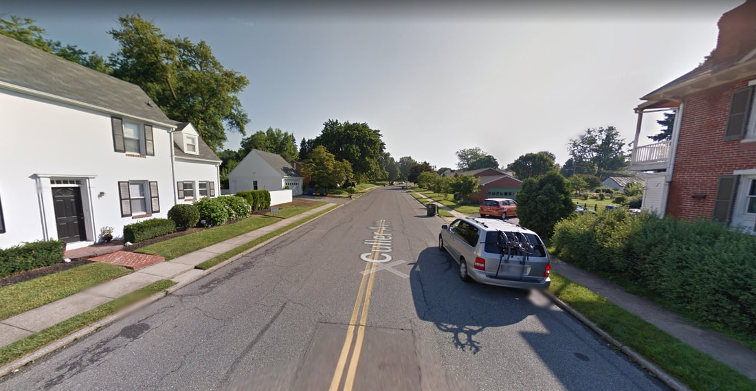 Culler Ave I assumed Culler Avenue was named for Lloyd Culler, former mayor. I was mistaken as I have since learned (from my assistant Marilyn) that it was named in honor of John M. Culler, the grocery store owner/Rosemont lot buyer who lived on Elm Street. Sadly, Mr. Culler would die in a car accident in 1935 on MD 26 near Mount Pleasant while returning home from taking his son back to school at Western Maryland College.
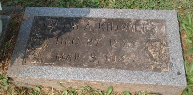
The street would be soon named in honor of the former businessman on a 1937 plat for a new subdivision called Rosedale, planned to encompass the Jacob A. Kidwiler property stretching from Fairview Avenue and the Rosemont subdivision, westward to existing Wilson Avenue in Villa Estates which had come about around 1930. The Rosedale property had been bought in 1931 from Henry Krantz, son of Edward Krantz who owned this property prior. You may remember Edward from another “Story in Stone” written just a few weeks back and entitles "A Statue of Hope". At the time, the purchase (Jacob A. Kidwiler) actually lived on the property where Frederick High School is now located before selling that to the Board of Education in 1938. 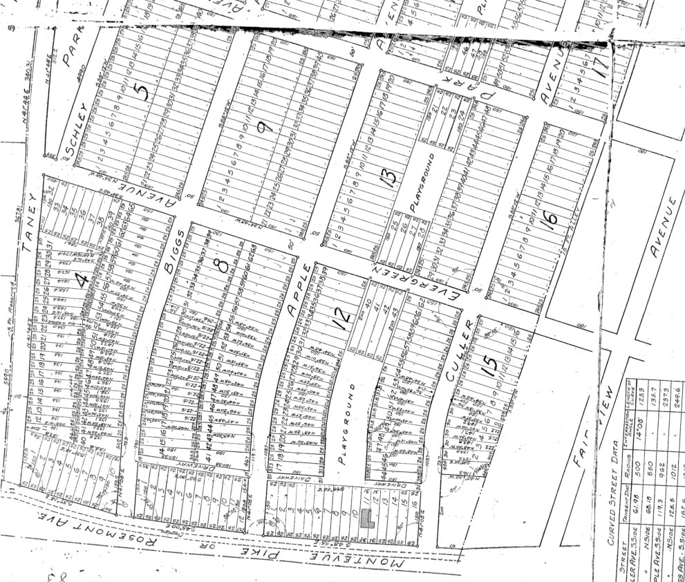 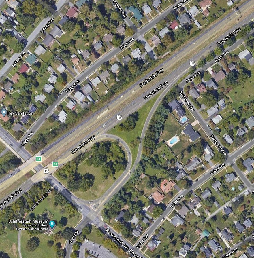 Anyway, there was no US15 bypass as yet as this would come in the early 1950s. As I pass by Schifferstadt Architectural Museum and go under the US15 overpass, I soon make an immediate turn right off Rosemont Avenue onto Biggs Avenue. I failed to mention Biggs earlier in my dazzling overview of the roadways of Villa Estates/Rosedale. To tell the truth, I was very interested to learn who the famed namesake was myself. I ride this road nearly every day, and my boys had their elementary school bus stop here. Well, with help from Marilyn, I learned that Biggs Avenue was named for the other major Rosemont development investor, John M. Culler’s brother-in-law, Elbridge F. Biggs, Jr. It's certainly a further stretch than Mr. Culler by having his name remembered in the form of a street, but no big deal I guess. Or should I say, "No Bigg Dill" instead? As you can see, this commute, albeit short, has made me quite punchy!
Although Mr. Biggs is entombed within the mausoleum at Clustered Spires Cemetery atop Linden Hills, John M. Culler and wife Ada Biggs Culler are buried in Mount Olivet’s Area AA/Lot 2.
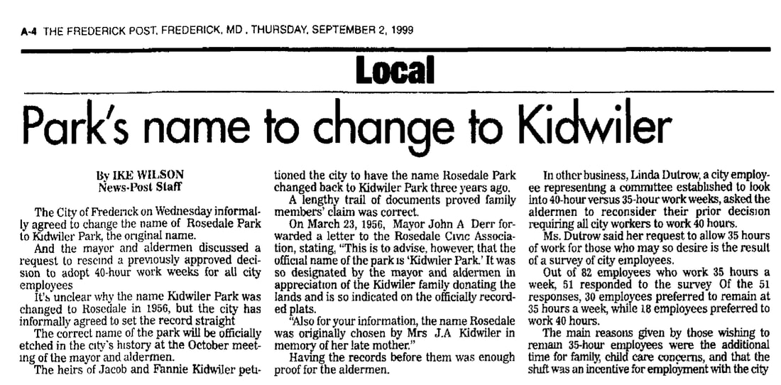
We also have buried here Mr. Kidwiler, "the former king of Rosedale" and a Spanish-American War veteran as well. His gravesite is in Area AA/Lot 84, not that far from that of Mr. Culler. I will write a more in-depth piece on him one day, but I learned that his name is the proper one for my neighborhood park as somewhere along the line it had wrongfully been changed to Rosedale Park.
  Blue Ridge Ave with former O'Connor residence on the left Blue Ridge Ave with former O'Connor residence on the left I know this sounds anticlimactic, but my third turn is a left onto Blue Ridge Avenue. It’s a short thoroughfare of two blocks with few speaking points. However, to the left, at the intersection with Schley Avenue, one can gaze at the childhood home of Frederick’s current mayor, Michael O’ Connor. This property (on the southeastern corner of the intersection of Schley and Blue Ridge) was sold out of the family a few years back, after Michael’s dad passed away. Saying this, I’m assuming we won’t see any museum or "mayoral library" placed here in the near future. 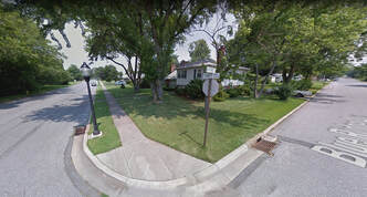 Taney Ave (left) Taney Ave (left) I cross Schley and proceed to the next sleepy intersection, where I make my fourth, and final, turn-- a right, onto my home street of Taney Avenue. I won’t get into the story behind that guy, but those who may have read my September 19, 2019 "Stories in Stone" article, know that Roger’s wife, Anne, and three daughters are buried in Mount Olivet. Anne Taney's brother, Francis, also has a nice burial site, complete with an impressive monument up by our front gate. I hope this story was worth the read, as it surely took far longer to do so than it takes me to drive my daily commute home. Thanks for the company, take care and stay safe!  "Stories in Stone" is made possible by:
3 Comments
4/16/2020 08:35:23 pm
This is a wonderful article. It’s going to take me many times reading it to digest it all. Since I grew up on South Market the chick hatchery was a favorite place to go in. I love chickens. The route you take is familiar, learning where the names came from and what it looked like years ago. .Fort Derrick then Camp Derrick was a scary place for kids in school as we has bomb drills. My husband mother lived on Wilson place. My uncle was a tenant farmer for Mrs Harnwell on Bachmans Lane by the creek that was close to Rosemont. The farm by the cemetery , do mean the Trout farm . Margie Trout the daughter was in my class. I used to play there. Oh the memories you pull out of me. My IPad won’t let me change the spelling of Dertrick. Again this a many times reading article. Thank You
Teresa Baines
4/17/2020 03:27:11 am
I look forward to each installment of Stories in Stone. Compliments on another great read.
Valerie Denson
8/12/2020 02:21:00 pm
Thank you for your research. I remembered hearing that my Uncle Ray, Ray D. Skeggs, had a shop downtown but never knew where it was located. He went on to work at the Frederick Motor Company for years. I do believe that he and Mr Fox were buddies and had quite the group that hung out together. My Uncle was one of the kindest men I have ever known and was glad to see him mentioned. Leave a Reply. |
STORIES
|

Archives
July 2024
June 2024
May 2024
April 2024
March 2024
February 2024
January 2024
December 2023
November 2023
September 2023
August 2023
July 2023
June 2023
May 2023
April 2023
March 2023
February 2023
January 2023
December 2022
November 2022
October 2022
September 2022
August 2022
July 2022
June 2022
May 2022
April 2022
March 2022
February 2022
January 2022
December 2021
November 2021
October 2021
September 2021
August 2021
July 2021
June 2021
May 2021
April 2021
March 2021
February 2021
January 2021
December 2020
November 2020
October 2020
September 2020
August 2020
July 2020
June 2020
May 2020
April 2020
March 2020
February 2020
January 2020
December 2019
November 2019
October 2019
September 2019
August 2019
July 2019
June 2019
May 2019
April 2019
March 2019
February 2019
January 2019
December 2018
November 2018
October 2018
September 2018
August 2018
July 2018
June 2018
May 2018
April 2018
March 2018
February 2018
January 2018
December 2017
November 2017
October 2017
September 2017
August 2017
July 2017
June 2017
May 2017
April 2017
March 2017
February 2017
January 2017
December 2016
November 2016
 RSS Feed